After Snow, extreme temps to remain

This photo, submitted by Jared Paxton, shows light (Ice) pillars over Chautauqua Lake in Bemus Point, Sunday night.
-

- This photo, submitted by Jared Paxton, shows light (Ice) pillars over Chautauqua Lake in Bemus Point, Sunday night.
-

- P-J photo by Michael Zabrodsky The Code Blue Warming Center, located at 917 Washington St.
Now area residents will have to deal with very cold temperatures.
According to the National Weather Service, a cold weather advisory is to continue until 1 p.m. today for Chautauqua County and Cattaraugus County.
Very cold temperatures will probably last until the end of the week. The service said that a reinforcing shot of Arctic air and increasing winds in the wake of the departing major winter storm will send wind chills down into the dangerous range across Southern Erie County and the western Southern Tier through early afternoon today. Expect wind chills across the remainder of the area to dip down into the minus 5 to minus 15 range.
With the snow came many closings. Chautauqua County Government issued a travel advisory that was scheduled to be lifted today at 5 a.m.
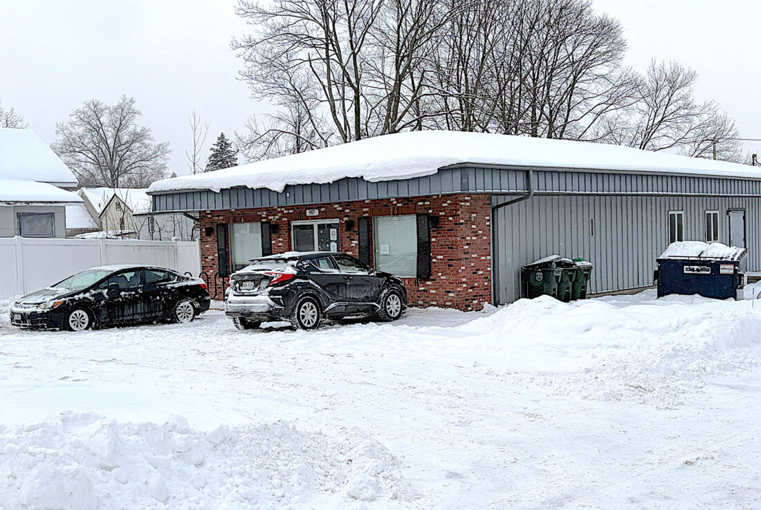
P-J photo by Michael Zabrodsky The Code Blue Warming Center, located at 917 Washington St.
The county implemented an Inclement Weather Policy. Office operations were to vary by department, with some offices closed to in-person services or operating remotely. Several in-person services were to continue as scheduled, including snow removal, emergency medical services, public safety operations, and other critical functions.
Residents were encouraged to call ahead before visiting any county facility in person and to check directly with individual departments regarding hours of operation and service availability.
Chautauqua County Emergency Services offers the following reminders to help residents stay safe during the winter storm. Avoid unnecessary travel, as road conditions may be slick, icy, or otherwise hazardous. If travel is unavoidable, drive slowly, allow extra time, and keep emergency supplies in your vehicle.
Residents should also dress in layers and limit time spent outdoors to prevent cold-related injuries. Use caution with heating sources — never operate generators, grills, or other fuel-burning devices indoors.
According to weather.com the forecast is cold. For Wednesday, cloudy with a high of 19 and a low of 8; for Thursday, mostly cloudy with high is 14 and a low of minus 5; for Friday, partly cloudy with a high of 11, and a low of minus 2; and Saturday, mostly cloudy with a high of 17 and a low of 3.
Snowfall around the area, according to the National Weather Service, was:
Jamestown – 11 inches
Randolph – 8.5 inches
Perrysburg – 8.2 inches
Dunkirk – 8.2 inches
Mayville – 7.9 inches
Bemus Point – 7.8 inches
Cassadaga – 7.6 inches
Falconer – 7 inches
Fredonia – 6.8 inches.
County officials encourage residents to check on neighbors, elderly residents, individuals with disabilities, or anyone who may need assistance during this severe weather.
County officials also remind residents to be careful when shoveling snow. With lighter, fluffy snow expected, cleanup may be easier than earlier in the storm. However, residents are reminded to avoid overexertion while shoveling or snow blowing.
Here are some tips when removing snow: Take frequent breaks; stay hydrated; push snow when possible instead of lifting; lift with your legs and not your back; and stop immediately if you feel chest pain, dizziness, or shortness of breath. Even lighter snow can still pose risks, especially for older adults or those with heart conditions.
TOP STORIES
Lots happening at annual Cassadaga Winter Festival
After Snow, extreme temps to remain

Borrello blasts green energy ‘savings’

Highway Departments brave snowstorm

Pomfret board sets special meeting to look at town hall floor plan
County legislators tout ‘Affordability Act’
County Legislators Bob Bankoski of Dunkirk and Tom Nelson of Jamestown, both Democrats, are sponsoring a Resolution ...