Pelletter uncovers historic maps of village
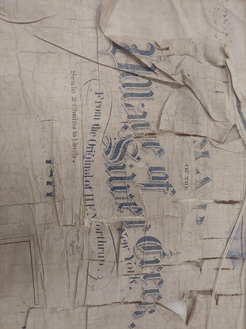
Submitted Photo Pictured is an official copy from 1877 of the H.F. Northrup Map of 1873.
-
- Submitted Photo Pictured is an official copy from 1877 of the H.F. Northrup Map of 1873.
-

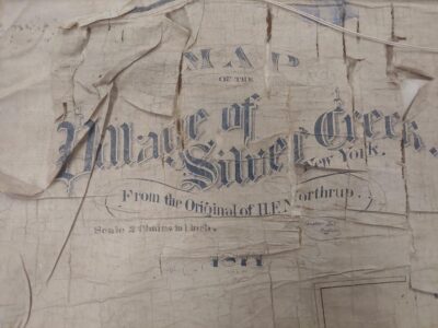
- Submitted Photo Pictured are the mapped streets of the Village of Silver Creek in the mid-to-late 1800s
Pelletter recently discovered an official copy from 1877 of the H.F. Northrup Map of 1873. The map shows the original property lines, dimensions for the legal road widths, the Right of Way of the roads, and property lots of the Village of Silver Creek at the time. It was deemed as “the only map of its kind in existence.”
Pelletter initially offered to see if he could find the maps from the 1980s and 1990s when the State of New York Department of Transportation (DOT) replaced the bridges and highways in the village. The state DOT surveyed Main Street and Central Avenue when they replaced the sidewalks, road and bridges. The state DOT then asked for the original map of the region, which led Pelletter to continue digging.
The map was previously discovered in the 1940s by E.H. Keyes, a surveyor of Forestville. He discovered the map while searching through the records of the late Robert N. Erdle, who succeeded the late Frederick Thomas in the insurance business. Surveyors, attorneys and abstract companies had searched for the old map in order to help them in their title work for approximately 40 years before Keyes discovered it.
Several streets appear on the map that have never appeared on any other map of the village. The map itself, with a scale of two chains to one inch, has a foundation of cloth with regulation black wooden braces at top and bottom, used for most maps of the period.

Submitted Photo Pictured are the mapped streets of the Village of Silver Creek in the mid-to-late 1800s
The Lake Shore and Michigan Southern Railroad was featured, but no other railroads had been built at that time. Most of the names of early families connected prominently with the growth of Silver Creek in that period were found on the map.
But Pelletter was not done with just one historic map discovery. He later uncovered another map, the O.N. Gardner Map of 1898.
Pelletter came across a copy of the Village of Silver Creek 1899 Code Book, which contained ordinances, bylaws and regulations governing the village at the time. In the preface of the book, it cited a map made by O.N. Gardner in the year 1898, which was said to be hanging in the building owned and occupied by the Village of Silver Creek.
Pelletter discovered Village Board Minutes of Sept. 28, 1898, in which the Mayor — at that time referred to as the President — was authorized to sign a contract to compensate O.N. Gardner for surveying and establishing grades for streets and sidewalks in the Village of Silver Creek in the amount of $400.
While the Northrup Map showed the layout of the village at the time, the Gardner Map showed the grade for the streets and sidewalks. In 1898, the streets were not paved, rather dirt or gravel.
Many of the streets had different names in the map than they do now. For example, Franklin Street is now part of Route 5; Newberry Street is now Lake Avenue; Hickory Street is now Porter Avenue; and Smith Mills Street is now Hanover Street. Chestnut, Dudley and Farnham Streets are paper streets.
Pelletter, now the Hanover Town Supervisor in addition to his role as Village Historian, will continue to look into more artifacts from the rich history of the Village of Silver Creek.
TOP STORIES

One more ‘positive force’

‘Nothing’ proposed yet by Genover for plant site

Winter of 2025-26 was the coldest in more than a decade
Anticipation builds for Big Boy travel through city
There’s big anticipation for Big Boy. A city resident inquired about the train’s travels through Dunkirk on ...

Wdowiasz hails addition of new comptroller for city