Flurry of activity
It’s a familiar tale in Chautauqua County this week, as residents there and across all of Western New York will face yet another upcoming storm front. This one, however, is a little different than some other storms.
According to Steven Welch from the National Weather Service in Buffalo, the duration of this particular forecast is what is unusual. The watch begins at 10 p.m. tonight and goes all the way until Friday afternoon at 1. This is a far cry from the normal duration of weather watches, which may cause some additional problems.
“Most storms you get these fronts in and out in a 12- to 18-hour duration,” Welch said. “But this one will be longer and that may cause some additional issues because of that. … We will start getting heavier snow Thursday morning, which might cause school closing issues into Friday morning because it’ll linger. It won’t be as heavy but it could cause issues with snow cleanup.”
Welch said to expect a lot of precipitation coming on this afternoon, with the rain mixing with and later turning into snow as the afternoon turns into evening. The warm weather of Tuesday and this morning coming ahead of the cold front will help prevent some rapid freezing, though untreated surfaces will get slippery quickly.
“The fortunate thing is the temperature won’t drop really fast,” he said. “The ground surface warmed up, which will help prevent some quick freezing. Untreated surfaces can still get icy as temperature drops.”
The stalled boundary that will be over Western New York and Central New York came from a wave of energy from the Mississippi and Ohio Valley areas, which is why the duration of the front was longer.
Because of the state of Lake Erie, there isn’t supposed to be additional lake-effect snow following the front, though the potential is there as the lake is only two-thirds covered in ice. “Lake Erie has quite a bit of broken ice and thin ice, so that potential is there behind it,’ but we’re not expecting too much lake effect behind it,” said Welch. “There is about 65% ice cover, but it’s not solid and energy from the lake can go through the broken ice.”
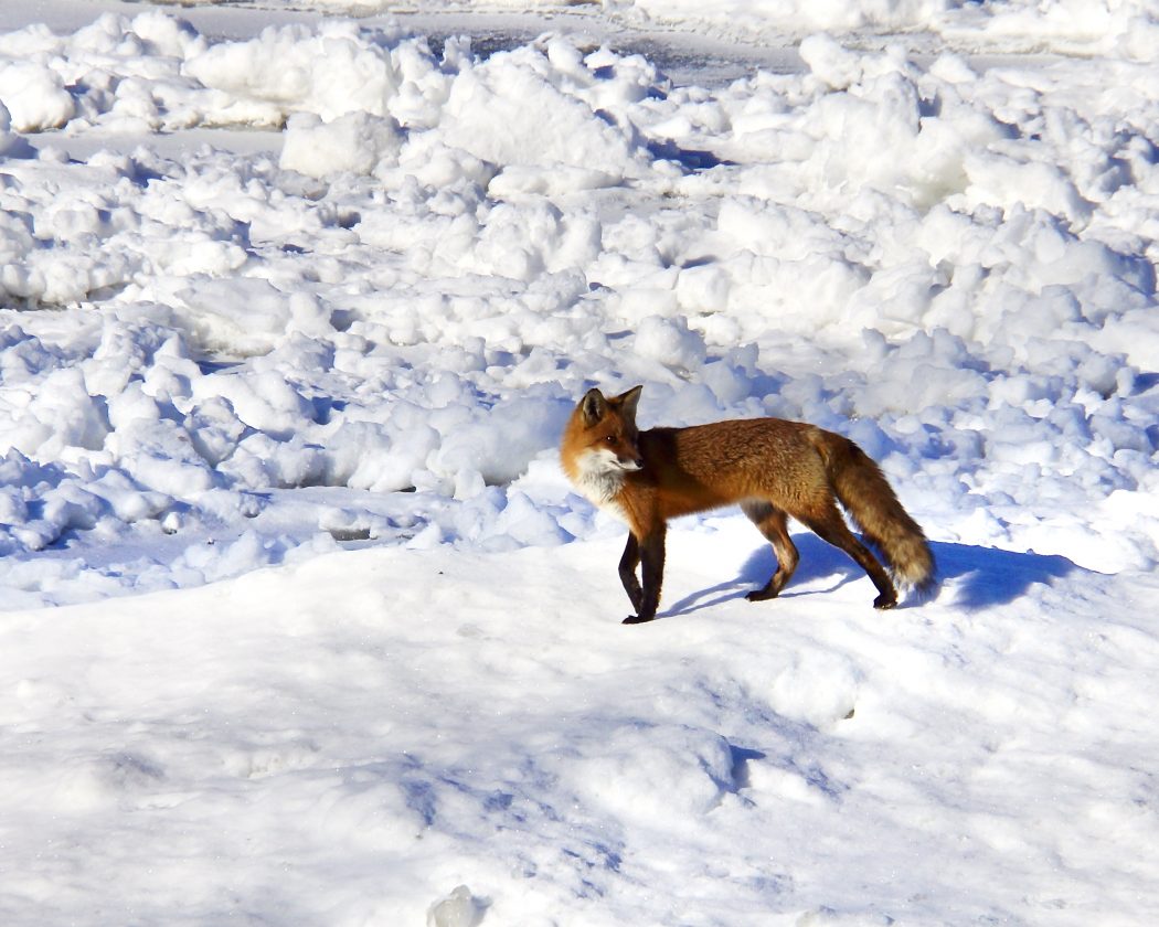
While the lake’s ice cover might not be enough to stop energy being pulled from it to contribute to a snow storm, it is covered enough to support something else: wildlife. Dunkirk resident Tom Prevet was having his morning coffee, when he noticed a family of foxes in his neighbor’s yard. From there, he watched them walk all the way onto the ice build ups on the lake to catch some morning sun. Prevet grabbed his camera and waited for the right moment to get some good shots.
“I waited quite a while,” said Prevet. “They were sunning themselves for quite a while and they came back toward me so I pointed the camera around the tree and kept shooting. I must have taken about 50 pictures, and when I stepped out from behind the tree, the one left ran to the middle of the lake. As soon as he saw me, it took off. I’m glad I stayed where I was for as long as I could.”
A member of Chautauqua County’s photography club, Prevet is experienced in taking wildlife pictures, and it’s not his first experience with foxes near his home. And while the weather that is set to occur over the next few days may be a major inconvenience to Chautauqua County residents, it can at least provide an escape outlet for some camera-shy foxes.
TOP STORIES

ImmunityBio CEO discusses plans plant
Ferguson wants Route 60 hotel closed
Fredonia Mayor Michael Ferguson wants the shutdown of a Route 60 motel notorious for violent incidents. “I have ...

Making the cut

Independent System Operator: Power grid margins dwindle
Union appeals ruling that favored city
A union has filed an appeal of an arbitration decision that went against former city of Dunkirk employee Kim ...
Ferguson calls for closure of Route 60 hotel
Fredonia Mayor Michael Ferguson wants the shutdown of a Route 60 motel notorious for violent incidents. “I have ...