Residents frustrated by DOT plans for Routes 5, 20
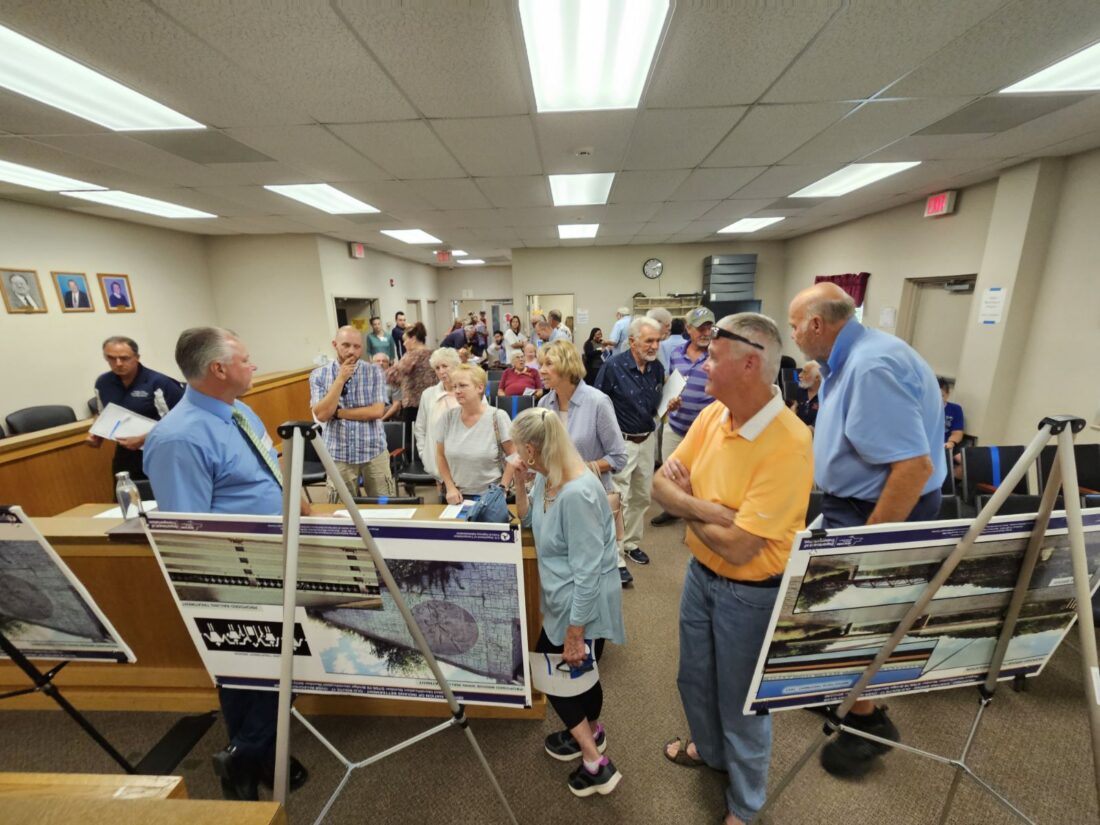
Photo by Aimee Rogers Hanover Town Hall was filled by members of the public for a DOT open forum regarding a proposed safety improvement project for Routes 5 and 20.
-
- Photo by Aimee Rogers Hanover Town Hall was filled by members of the public for a DOT open forum regarding a proposed safety improvement project for Routes 5 and 20.
-
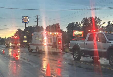
- Submitted photo An accident occurred in the area of the proposed safety improvement project around 6:30 a.m. Wednesday.
-
- Pictured is one of the maps displayed by the state Department of Transportation.
That is not what turned out to be the case.
“It was a surprise. We thought it was a sit-down meeting,” said Aimee Rogers, a resident in attendance. “It would have been nice if they had done that, because there were a lot of repeat questions, I’m sure, that they could have addressed at once and everybody would have gotten an answer.”
Rogers added, “A lot of people left because they saw it wasn’t a meeting. They were definitely disappointed.”
The project spans from the bridge coming off the Seneca Nation territory near the roundabout, to the split in the road where vehicles can take Howard Street or Central Avenue into the village of Silver Creek.
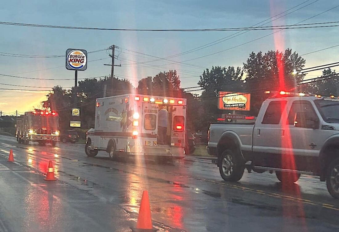
Submitted photo An accident occurred in the area of the proposed safety improvement project around 6:30 a.m. Wednesday.
The DOT, as cited in a previous article that ran in the OBSERVER on Aug. 16, stated the gathering would be an “informal, open house meeting” and that “no formal presentation will be made.”
A formal presentation was previously made by the DOT at the Town Board meeting on June 26. At that meeting, Scott McKay, an assistant Regional design engineer for the state DOT, presented a map and plan to transform the four-lane road into a three-lane road, with a middle lane to serve as a two-way left turn lane.
McKay was among five representatives from the DOT in attendance on Tuesday to field responses from the community. Throughout the public meeting, crowds gathered around McKay at the front of the courtroom at the Hanover Town Hall, where plans for the project were displayed.
The project still remains in the “preliminary design” phase, according to Susan Surdej, NYSDOT Region 5 public information officer. The recent public forum was held to solicit feedback before the plans are finalized.
“We really want their comments,” Surdej said. She noted that comments can be submitted via phone call, traditional mail, or email through the Department of Transportation. “We encourage people to get us their comments by Sept. 12 so that we can move forward in the process,” she said.
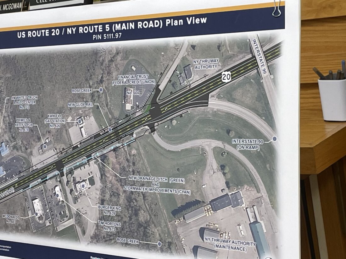
Pictured is one of the maps displayed by the state Department of Transportation.
VOICING FRUSTRATIONS
On Tuesday, many residents voiced their frustrations with the process of the DOT project, as well as the plan itself. Among the frequently raised concerns was the speed of traffic exiting the Thruway and merging into traffic on Routes 5 and 20. Without a stop light to slow traffic from merging, reducing to one lane each direction has the potential for dangerous collisions.
“That’s definitely something that we will take a look at,” Surdej said.
Town Board member Lou Pelletter, the town’s deputy supervisor, has plenty of familiarity with accidents in the area, as he previously served as a police photographer. “It’s a very dangerous road. It used to be 55 (mph speed limit) and they lowered it because of people stopping dead to make a left turn,” Pelletter said. “It’s a very treacherous road.”
However, aside from not having an answer yet to slowing traffic exiting the Thruway, the plan was developed by the DOT as a way to improve the safety of the area.
“The goal of the project is to reduce the accidents out there,” McKay said at the DOT presentation in June. That area alone featured 67 accidents over a three-year period evaluated by the DOT.
Many of the accidents occurring in the area are left-turn accidents and rear end accidents. The DOT hopes that with the addition of a turn lane, coupled with two lanes of traffic being reduced to one each way, approximately 50% of the accidents could be prevented by moving forward with the new plans.
“By eliminating the two lanes in each direction by going to one lane in each direction and creating that left turn lane, you’re getting those people making those lefts, that are stopped, out of live traffic,” Surdej said. “The safety benefits of that are great.”
‘ONE ACCIDENT AFTER ANOTHER’
Coincidentally, the following morning, a motor vehicle accident occurred in the exact stretch of road that necessitated action from the DOT in the first place, in front of the Tim Hortons, McDonald’s, and Burger King locations.
“It’s one accident after another,” Pelletter said at the June presentation. “The bottom line is, there’s way too many serious accidents there.”
While the plan eliminates a lane in each direction, it does incorporate a crucial part of what Pelletter has been asking for going back decades, a center turning lane.
“In 2007, I went to the hearing at Sunset Bay for a five-lane highway,” Pelletter said. “I wanted two lanes east and west, with a turning lane. I like the two lanes, but we need a turning lane, just like they have in Dunkirk and Fredonia.”
The DOT conducted multiple traffic studies and determined the area does not warrant a five-lane road because of the number of vehicles that pass through the area on a regular basis.
“We’re confident one lane in each direction is more than adequate to handle the traffic that comes through,” Surdej said.
Additionally, Surdej stated that reducing the lanes will slow traffic to more manageable speeds. That point was also made by McKay at the June presentation, where he reported the 85th percentile speed in the area is 54 miles per hour, when the speed limit is 45 miles per hour. The proposed adjustments are expected to decrease speeds by 3-4 miles per hour, which would put the figures closer to what the current speed limit is.
CHANGES MADE
Since the presentation in June, the DOT has lengthened the turn lanes at the intersection at Allegany Road, where there will be a left turn lane, a straight lane, and a right turn lane.
“They did make some changes, I’ll give them that much,” Rogers said. She was in attendance at the June presentation from the DOT, where she proposed a bike lane be added to allow for a true bike trail through the area.
There has also been more drainage work incorporated into the project to mitigate flooding concerns in the area, which date back to the road’s history as a floodplain prior to 1850. “We’re making a lot of drainage improvements to prevent some of the flooding historically that we’ve seen in this area,” Surdej said.
The project is scheduled for construction in fall of 2024, with completion by fall of 2025. “Construction, no matter how well-planned, is obviously disruptive to a community. We try to eliminate those disruptions as much as possible, but it’s not completely possible. There’s going to be lane closures, lane shifts, but over a relatively short period of time for the benefit that we’re going to get,” Surdej said.